London A-Z Details
| Map | Coverage | Download Size | Android | Apple | Price |
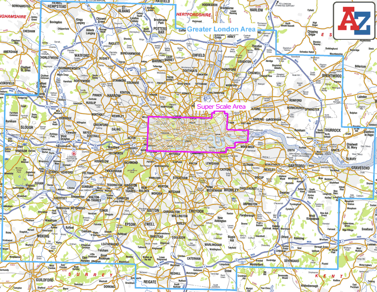
| Greater London | Covers 3743 sq km (1445 sq miles) of London, the same area as the paper version of the A-Z Master Atlas of Greater London and extends beyond the M25 and Greater London area to Hemel Hempstead, St Albans, Potters Bar, Waltham Cross, Epping, Brentwood, Thurrock, Stanford-le-Hope, Gravesend, Wrotham, Sevenoaks, Westerham, Oxted, Redhill, Reigate, Leatherhead, Great Bookham, Woking, Egham, Windsor, Slough, Chalfont St. Peter, Chorleywood and Bovingdon. | 351mb | Yes | Yes | £4.99 |
| London Super Scale | This is a large scale map of central London, covering the West End, City, Docklands and Stratford, the area extends to Swiss Cottage
,Camden Town, Islington, Hackney, Queen Elizabeth Olympic Park, Canning Town, Beckton, London City Airport, The O2, Greenwich, Deptford, Vauxhall, Chelsea, Earls Court, Shepherd's Bush, White City, Maida Vale & Kilburn.
This Super Scale mapping is our most detailed London mapping and shows, the entire Congestion Charging zone boundary, Cycle Hire Docking Stations, selected safety camera locations (with maximum speed) and red traffic light cameras, selected places of interest, theatres, cinemas & much more. |
105mb | Yes | Yes | £2.99 |